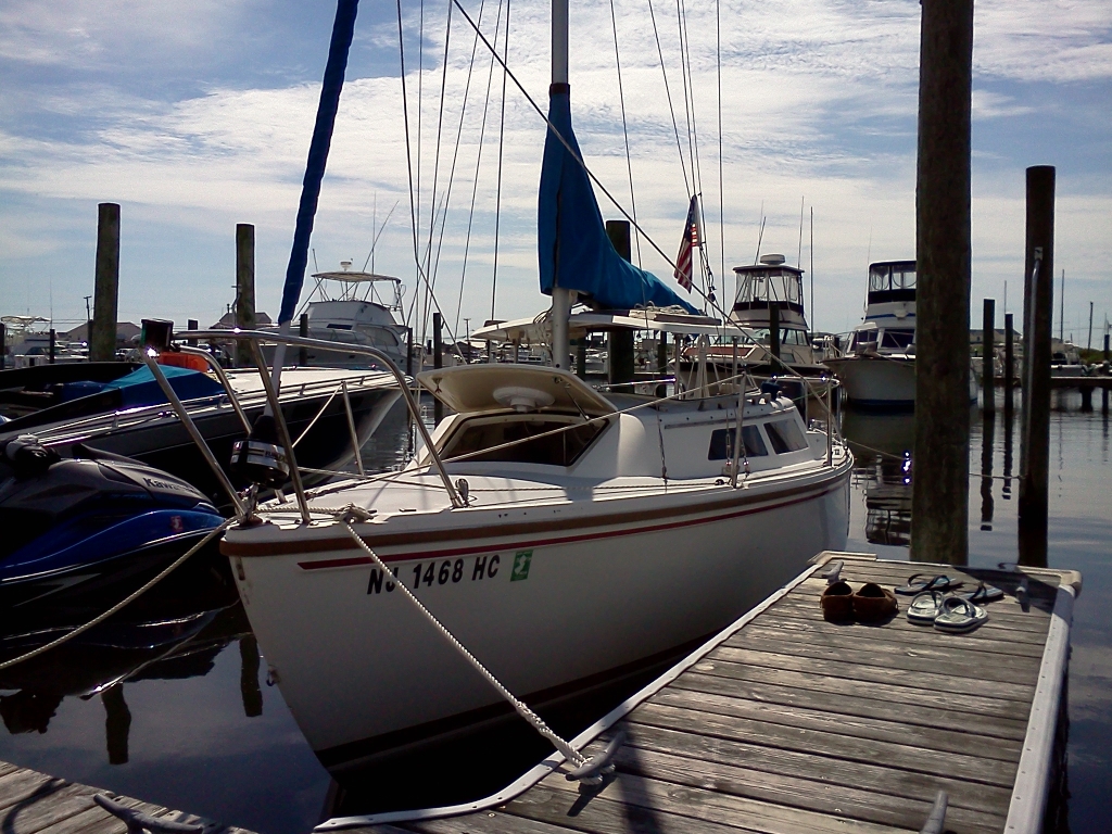
Only a couple months after our Cruise to Beach Haven, we have shattered our distance record by sailing to Tuckerton, and we did it on our own.
This was Phase II of a week-long vacation. The first half was spent in the Thousand Islands region of New York with Jen’s parents, which included a lot of fishing, games, relaxing, and good eating. We knew that we wanted to sail for the second half of our vacation, but weren’t exactly sure what that would entail. The northern reaches of the Barnegat Bay were appealing, since we’ve never been beyond Silver Bay in that direction (see Cattus Island Beat Down) and I even went as far as to inquire to some fellow Windjammers about possible anchoring locations in the Metedeconk River. The weather report, however, was not favorable.
Predicted northerly winds on our departure date, which are unusual for the Jersey shore, had us instead looking south. Tuckerton seemed appealing: we were familiar with about half the route from our trip to Beach Haven, we had some tickets for the Tuckerton Seaport and Bayman’s Museum, and we’d actually thought about sailing there on our “off day” while in Beach Haven with the Windjammers. It has also been a point of interest for us and our friends for some time. The root beer stand there had been the site of our group of friends’ single most heated laundry discussion, and it’s where we learned that Tuckerton was America’s third port of entry (although that is apparently disputed.)
As usual, we departed a little later than we would have liked, shoving off around 11:30 on Friday. Yes, I know that starting a voyage on a Friday is supposed to be bad luck, but so is having a woman aboard. I’ll take my chances on both counts. The wind prediction was the usual 5-10 kts—the weatherman’s equivalent of shrugging sheepishly—and the meter at Trixie’s was actually reading 6 kts NNW when we left, but as soon as we got the sail up it immediately dropped to the 0-1 kt range. We couldn’t even get past Berkeley Island. A MacGregor 26X started creeping up on us somehow, and rather than be passed we fired up the motor and got out of there.
That would be the tone for the rest of the day. We motor sailed up to BB where we actually started heeling from all the wind, but by the time we got the motor lifted and the jib out, poof…nothing. We sailed from BI to 44, but then the wind started shifting and we couldn’t point high enough to follow the markers, so we wound up motoring some more. When we got to about 54, we were able to sail again, now in much stronger winds, but ran aground somewhere around 63 where the channel is apparently 12′ across and only marked on one side (thanks). It was kind of hairy there for a moment, with Jen very carefully lifting the keel as I tried to dump wind out of the main to keep us from heeling too much while still getting back into the deeper water, but we made it, and switched to motoring once again for the approach to the bridge.
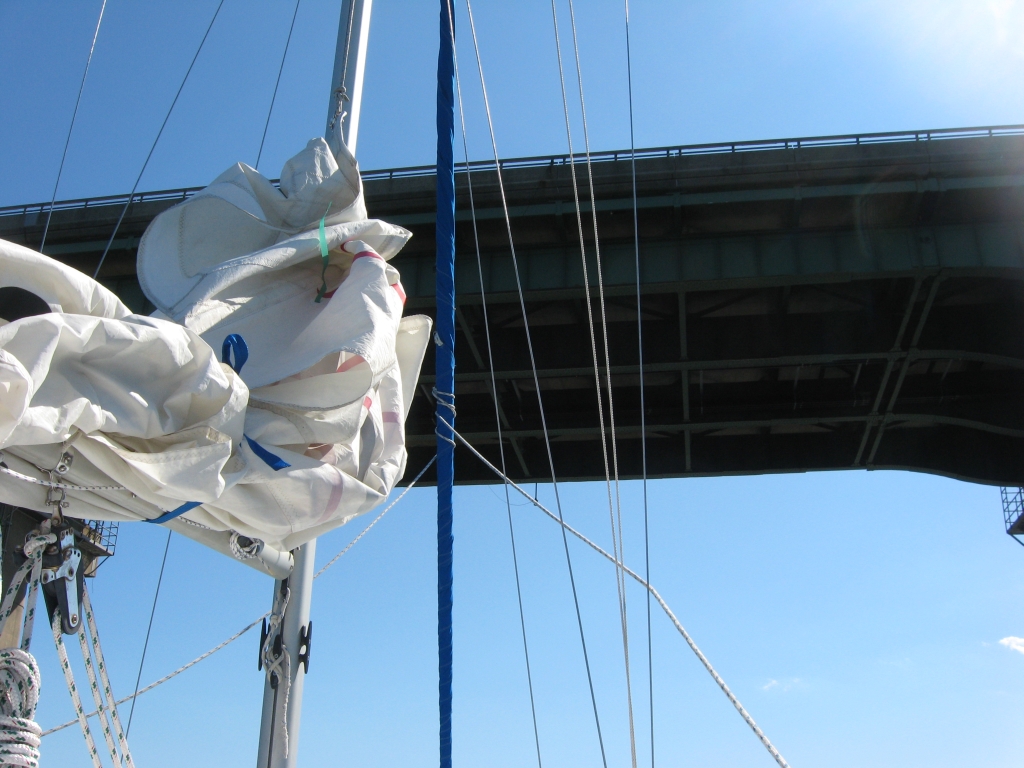
I’m not sure why going under bridges is so momentous, especially since this was now our third time under the Manahawkin Bay Bridge (second southbound), but even through I’ve driven over this bridge countless times, it’s interesting to be part of the reason that they gave it 60′ of clearance. Incidentally, while looking up the correct name of this bridge, I found that it’s technically been the the Dorland J. Henderson Memorial Bridge since 2000, though to my knowledge most locals still call it The Causeway.
On the other side of the bridge, we almost immediately broke away from our route to Beach Haven and entered unfamiliar waters. I had studied the charts to the best of my ability before we headed out and they showed three separate fingers of deep water meandering around Thorofare Island and leading to the channel on the western side of Little Egg Harbor, all of them unmarked. Jen and I could have sworn that we saw little non-Coast-Guard-maintained markers the last time we were down there though, so the plan was to follow the first marked channel that we could find and follow it around the best we could before resorting to our not-to-be-used-for-navigation chart plotter.
As it turned out, the first channel was well-marked, and I followed it under the auxiliary while Jen went below to make a late lunch. I was naïvely wishing that the markers would continue all the way to Tuckerton, but they ran out before Jen had even finished making sandwiches. I nervously proceeded with the “eyeball the chart and hope” method of navigation, while Jen tried to get a GPS fix from inside the cabin. When she innocently asked “are we anywhere near the Brigantine Inlet?” the anxiety got to me and I went a little bad captain. I tried to reel it in as quickly as possible as Jen’s phone acquired more satellites and eventually told us where we were. There’s no getting around that this was simply poor seamanship on my part, but I suppose that these are good lessons to be learning early on, in low-stakes cruising. I’ve got the hand bearing compass and parallel rules on my Christmas list.
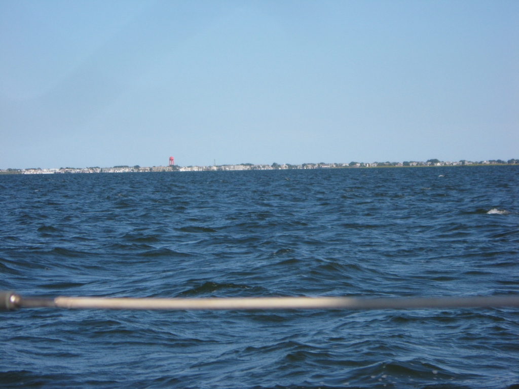
As it turned out, there was really no problem. My guesstimation on where the channel should have been based on the chart was spot on, and with an assist from Jen’s app, we followed it the rest of the way without issue. We continued to motor with the wind right on our nose with building waves and building anticipation as we sailed into the wide part of Little Egg. There was almost no one out and not much to look at with seemingly endless marshes, but that’s actually interesting for Jersey sailing. It really sank in how far we’d come when we saw the orange Beach Haven water tower off of our stern.
When we actually got to the Tuckerton Creek, I was mostly surprised at how small it is. The town was settled in 1698, so I figured it was more substantial. I’ve seen it up by Route 9 and knew it was small there, but man, it’s a little thing.
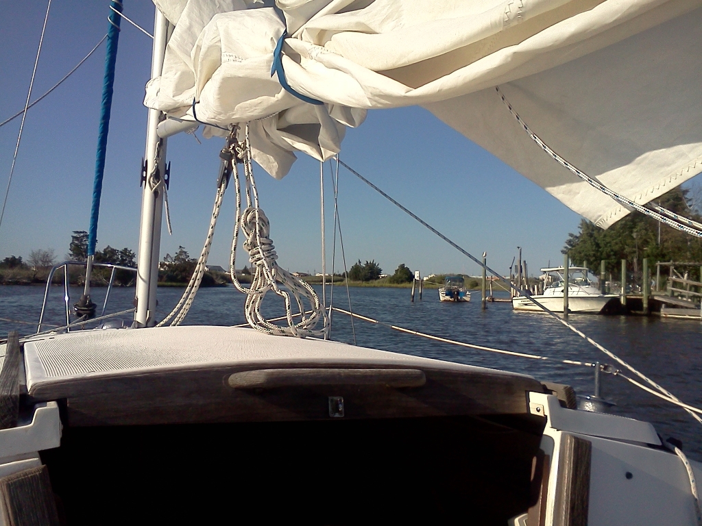
We found Sheltered Cove Marina, where I had made a reservation, around 5:30, although once we got in there we couldn’t find our slip. I was about to call when we found a guy on his Formula power boat and asked if he knew where our slip was, which happened to be directly next to his. He started to tell me that maybe I shouldn’t dock there because the person with the Wahoo in the adjoining slip was pretty green, but I had already started my approach (without really properly lining up or slowing down since I didn’t know that that was the slip) and did some subtle crashing of my own. This guy and a kid helped us get back out of that slip and into the one on the other side, and we tied up. I had to re-tie us three times after slowly figuring out how a floating dock works and what the ring was for on the doodad that this guy was calling a Jacob’s Ladder. I know lots of definitions of Jacob’s Ladder (biblical ladder to heaven, electrical novelty, world’s least interesting toy, Bruce Hornsby song, etc.) but this was a new one.
This person (whose name we never got although I feel like it may have been Rick? Are we the most antisocial people ever?) turned out to be very helpful. He has the personality type that some of my friends call The Mayor: though not duly empowered in any way, these types of people just have the right mix of knowledgeable, intrepid, and nosy that tends to land them as the de facto authority. The marina office was closed by the time we arrived, so if it wasn’t for [let’s call him] Rick we wouldn’t have even gotten the bathroom code. He was very forgiving of our docking, seeming to give a lot of credence to the difficulties of docking a sailboat (this was not a sailing marina), but continued to be very critical of his regular neighbor’s docking and of the marina for not giving us a better slip. He was certainly correct about the Wahoo, whose docking debacle would have totaled our boat before he even fully got in there sideways. It all worked out though, and we found the marina to have excellent facilities and truly friendly clientele.
I played the boat guitar as the sun set and the full moon rose, and sampled some DonQ Cristal that Jen’s sister brought back from Puerto Rico, or somewhere down there. It was surprisingly nice…based on nothing, I was kind of expecting it to taste like isopropyl, but it may just be the vodka-like packaging and color. It made an excellent Cuba Libre. We then went to the Tuckerton Beach Grille for dinner. We were most impressed with the desserts…Jen got some kind of crazy strawberry cake and I got what amounted to a pail of Crown Royal. Despite the booze, I didn’t sleep well, which is a trend that bothers me. I never seem to sleep that well on the boat.
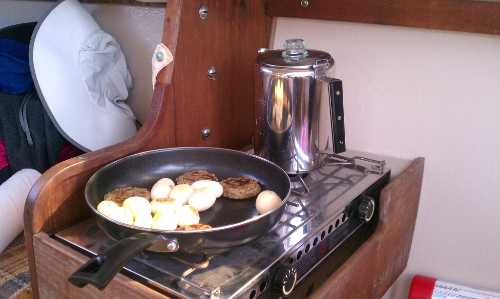
On Saturday morning, after a lengthy wake up period, I made some fantastic turkey sausage, new potatoes, and Café du Monde coffee. Actually, I’m still not sure how I feel about the chicory outside of New Orleans city limits, or maybe it’s just that they make it as “café au lait” and I prepare it as “coffee au sugar and served in a tin mug.” The breakfast was no Dock Six Two-Burner feast, but it’s the effort that counts and everything seems to taste better on a boat.
It was our hope that we could spend another night in Tuckerton, but the weather forecast for Sunday was dreadful. We made the call to ship out and save our Seaport Museum vouchers for a day when we can really spend some time there. We left around 11:30, backing out of the dock with incredible grace since no one was watching.
The wind was now steady from the south east and we were able to sail back across the Little Egg Harbor just broad of a beam reach under full sails. We ran into some sort of regatta that looked like it was mostly E-Scows, tearing across the bay flying spinnakers. We carefully picked through them, giving them lots of room and making no attempt to defend our starboard tack.
With Jen acting as navigatrix, we had no trouble following the winding channel leading up the western side of the bay, and we sailed almost all the way. We did motorsail around Thorofare Island and through the bridge, just to be safe, but we could have sailed the entire way if we’d wanted. Jen took over the helm on the northern side of the bridge and sailed us up to the mid 50s. We did touch once, but it was just a ridiculously skinny part of the ICW and no fault of hers…we were directly next to a marker and should have been in 8 feet according to the chart.
We actually made it all the way to 49A on one tack, where we had to jibe to follow the channel. From there, we were on a very broad reach and the jib didn’t want to set either behind the main or wing on wing, so we furled it and just sailed on the main until we got to 42, where we had a long stretch of dead downwind. We put out the entire jib and actually kept ahead of an S2 9.2 who was shadowing us on just a main. There were dark clouds building behind us and the wind and seas livened up a bit as we got close to home. Even after we switched back to just the main, we had the keel cable singing. I guess the point here is that although this isn’t big water sailing, it feels pretty technical to sail point to point over the course of 28 miles or so.
We eventually made it back to Berkeley Island and took down our sails to head in to Trixie’s—tired, but contented to have made it. As we motored into the cove and made the left turn to follow the deep water in, I saw a sport catamaran roaring up on our port side, flying a hull. I figured I was being overtaken, so I straightened out to let him go. The grizzled skipper was unhappy with this maneuver, though, and started yelling at me to continue turning. He just missed us to starboard, shaking his head in disappointment as he passed, and shot over to the marshes on the far side of the of the cove. I was kind of freaked out, and was going over the colregs in my head as we continued toward the docks when this strip of human jerky came back for a second pass, flying a hull over our boat. I guess that I was hesitant on the first near miss and I can see why that would be annoying, but I can’t understand why he then needed to make a display of it. I kind of regret not confronting him, but I was truly dumbfounded, and doubt that anything constructive would have come from it.
That absurd incident aside, we had a fantastic adventure. According to my crude scribbling in Google Earth, I think we went about 56 nautical miles total, taking about 7 hours each way, the majority under sail. This was slightly farther than our Beach Haven cruise, and we did it without the club—not that it’s not fun to sail with the club too, there’s just something to be said for doing it on your own. We would have liked to have spent another day in Tuckerton, but as the crew of Waterloo told us in Beach Haven: that’s cruising. You can’t dictate your itinerary to the weather, and we made the right call. The only problem having this much fun sailing is that we can’t do it every weekend.
More photos are in the gallery here.
