Opinions on how much navigational knowledge one needs to safely operate a boat on protected waters run the gamut from “meh” to some variant of “Farewell and Adieu to you Fair Spanish Ladies.” Although we’ve been sailing around with paper charts, a telephone, and our eyeballs for some time without much incident, I’d like to know more.
Most people figure out where they are with electronics—things like GPS and chart plotters. The saltier sailors will go on about the fallibility of electronics when they’re most needed, and how the government could pull the plug on GPS at any time (and indeed, the marine community has been closely watching an FCC decision on whether or not a tech company could borrow some airwaves that might interfere with GPS signals), but those aren’t really my concerns at the moment. We don’t have the space, the electrical capacity, or the funds for a chart plotter on Fortuitous (beyond the “not for navigation” one in Jen’s telephone), and honestly the bay is well-marked and easily navigated without much assistance. The long-term goal, however, is to sail beyond the bay, and while we’ll probably have a chart plotter on board when that day comes, I’ll feel better knowing how to do traditional coastal piloting. Not to mention that I’m simply interested in nautical esoterica.
Piloting is a subset of navigation that deals with determining your position based on fixed references. If you know you’re pointing at buoy BB and you can measure the angle to Barnegat Light or a water tower or something else on the chart, you can plot your relative position to these things and make a good guess as to your location. Piloting is used when operating close to shore and often in conjunction with things like dead reckoning (using time, speed, and direction to figure out where you should be). Celestial navigation (using the angles of things in the sky to determine your position) can be done almost anywhere, but really excels offshore, where there are no landmarks to reference.
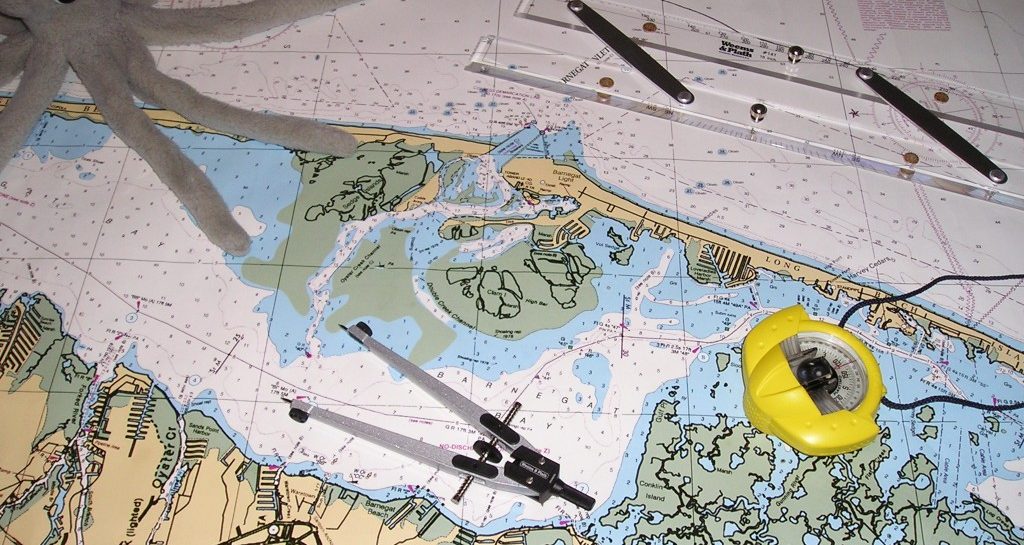
So here’s what I’ve got (in addition to charts, pencils, and erasers), which I’ve collected based off of my initial readings in Chapman’s Piloting and Seamanship and from the kits recommended for introductory piloting courses:
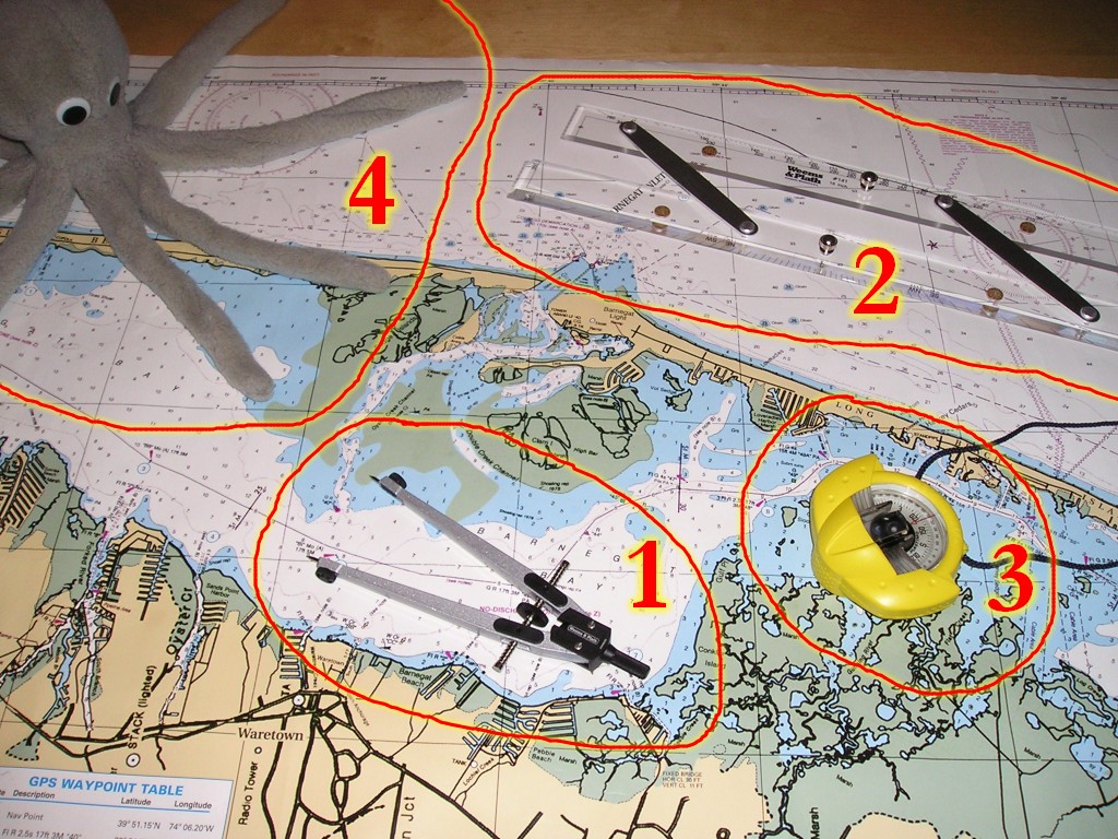
- Weems and Plath 7″ Dividers: These are used to measure distances on the chart, in conjunction with the chart’s scale.
- Weems and Plath 15″ Parallel Rules: Two rulers that are linked so that they always stay parallel to each other. Click here to see an animation of how they’re walked across a chart to transfer a course to or from the compass rose.
- Plastimo Iris 50 Hand Bearing Compass: The boat’s compass always shows the direction in which the boat is pointed. This compass will allow us to figure the relative directions of other objects. I think this could also be useful in racing too, since if we know how far off the wind we are in one direction we’ll know how far off we’ll be on the other tack, and could potentially more precisely tell when to come about to make the mark.
- Avast! Thar be a scary sea monster! I think this one is friendly, but it’s important to know how to navigate around the more aggressive ones. Check out how freaked out sailors were in the 1500s: The Carta Marina is one of the earlier maps of Scandinavia, published in 1539 by Olaus Magnus. These poor guys could barely make it out of the harbor without running into a stray charybdis or boat-eating lobster. Note also that divider technology hasn’t changed much in the last 500 years. There are a bunch of other sea monsters for your amusement here.
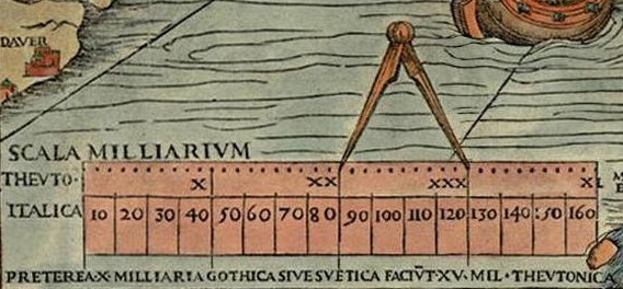
I’m going to see how much navigation I can pick up with my books and Internets, although I may wind up taking a formal course at some point. I think it’s a good skill to know. It feels like proper seamanship and it’s arcane enough to hold my interest. By the time we get a bigger boat, I’ll probably be able to pick up the US, Russian, and European satellite positioning systems and communicate directly with the ghost of Steve Jobs with an iHead brain implant (Apple: Bringing Proprietary to your Pituitary), in which case I’ll definitely be using paper charts, but for now this should just be fun to learn.
Consider a USPS “Coastal Pilotage” course, Chip. They are usually cheap and teach you the basics of vectoring off land marks, figuring out distance from shore with a watch, and stuff like set and drift.
They are essentially ways to give you the situational awareness aspect of sailing, which you cannot get from lat/lon pinpricking or display eyeballing.
Besides, if you figure out your position within a hundred metres of where the GPS says you are, you feel pretty salty, leading to the purchase of a nicer brand of rum.
I use the GPS once a hour while sailing up or down the lake, “offshore” three to five NM, to confirm observations when doing my log. I also calculate ETAs separate from my GPS’s opinions. While motoring or motor sailing, I have power to the 12 VDC outlet, and (usually) an elderly Autohelm 1000 doing the steering. That’s when I have the GPS on constantly (because it doesn’t eat batteries) and note course deviation due to accumulating steering errors or the presence of currents.
I nearly T-boned a fishing boat in fog while under autopilot, but the fact I was standing up away from the tiller meant I heard “something” off the starboard bow with my ears (the fog was very thick and very low, maybe two boatlengths of visibility, but with a glaring sun only halfway up the mast…argh…)
So I was able to dash back and throw off to port, avoiding some surprised guys in a 20 footer with about eight rods out.
There’s your Coastal Pilotage, right there. After that, I used the ship’s bell…yes, I have one.
Ladies and gentlemen, I present to you: the saltier end of the [freshwater] sailing spectrum. 🙂